Search
06 Sept 2025
Search
06 Sept 2025
Please allow ads as they help fund our trusted local news content.
Kindly add us to your ad blocker whitelist.
If you want further access to Ireland's best local journalism, consider contributing and/or subscribing to our free daily Newsletter .
Support our mission and join our community now.
To continue reading this article, you can subscribe for as little as €0.50 per week which will also give you access to all of our premium content and archived articles!
Alternatively, you can pay €0.50 per article, capped at €1 per day.
Thank you for supporting Ireland's best local journalism!


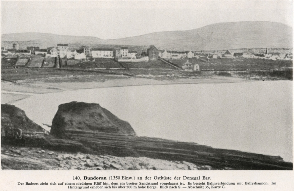
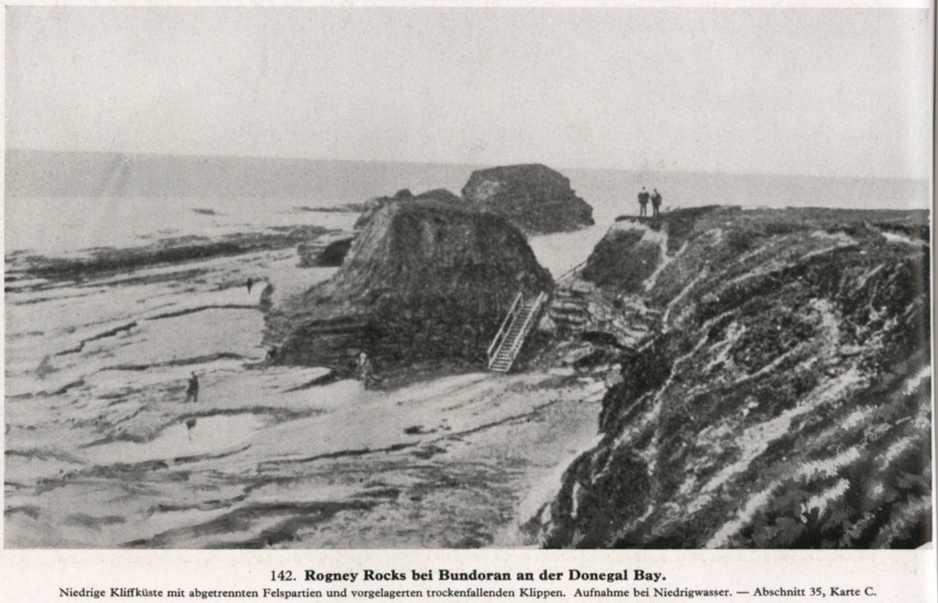
Within the booklet, there are four photographs of Bundoran, one photograph of Ballyshannon and two of Teelin. Three of the four photographs of Bundoran show the coastal scenes around Main Beach, Rougey Rocks, and Donegal Bay.
These photographs were either tourist photographs that the Nazis used for reference, or they could have been taken by the Nazi spies in Donegal.
The most striking photograph is the aerial photograph of Bundoran, which captures an overview of the Drowes River and the Erne estuary. The Donegal Corridor was clearly on the Nazis' radar.
This Luftwaffe aerial photograph was taken in 1939 at the start of World War II. It is a unique image because it is the only aerial photograph that the Nazis took of Donegal.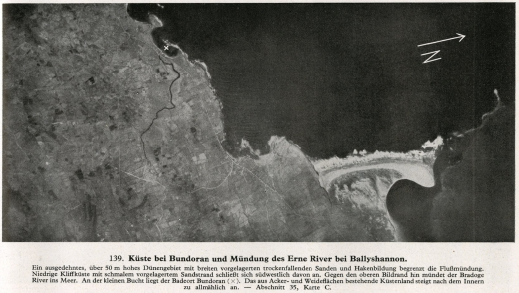
The Nazis made a couple of mistakes in the caption of this photograph. They erroneously referred to the Drowes River as the Bradóg River, and they also claimed that the X on the aerial photograph indicated that Bundoran is located on the small bay, when the X is actually positioned by the Drowes estuary.
The Nazi spy who detailed the aerial photograph in the Bundoran area provided incorrect information. One possible candidate for the spy who took the Teelin photographs in Donegal is Nazi professor, Dr Ludwig Mühlhausen. He lived in Teelin in 1937.
Mühlhausen took photographs, scoped out the potential secret U-boat submarine base and reported to the S.S.
.

Subscribe or register today to discover more from DonegalLive.ie
Buy the e-paper of the Donegal Democrat, Donegal People's Press, Donegal Post and Inish Times here for instant access to Donegal's premier news titles.
Keep up with the latest news from Donegal with our daily newsletter featuring the most important stories of the day delivered to your inbox every evening at 5pm.
This publication supports the work of the Press Council of Ireland and Office of the Press Ombudsman, and our staff operate within the Code of Practice of the Press Council. You can obtain a copy of the Code, or contact the Council, at www.presscouncil.ie, Lo-call 1800 208 080 or email: info@presscouncil.ie.


